Announcements and Highlights
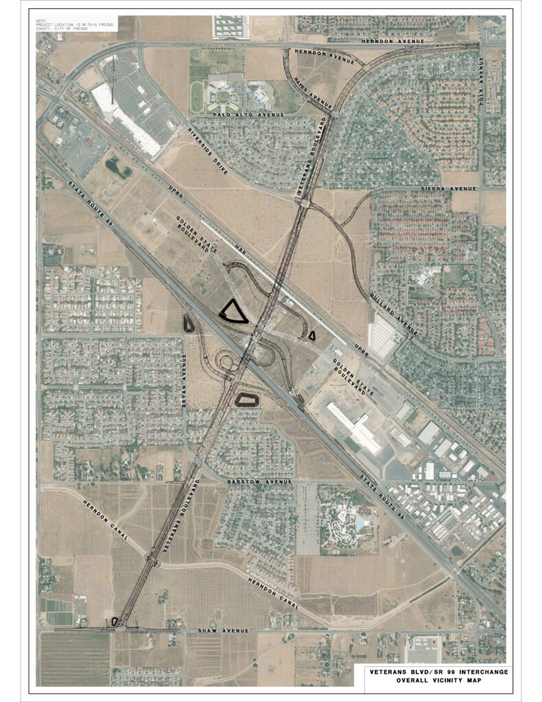
Veterans Boulevard
The Veterans Boulevard Project includes the construction of a new six-lane super-arterial roadway in northwest Fresno; an interchange at State Route (SR) 99, with a grade separation over the realigned Golden State Boulevard and grade separation of future California High-Speed Rail Authority (CHSRA) tracks and existing Union Pacific Railroad (UPRR) track; a northern extension of Veterans Boulevard to Herndon Avenue; a southern extension of Veterans Boulevard to Shaw Avenue; a 12’-wide Class I multipurpose trail; and installation of adaptive intelligent transportation technology for traffic synchronization.
Overall project work was split into the following design and construction phases to accommodate scheduled utility relocations, expedite existing funding, and create appropriately scaled opportunities for local contractors to participate in the construction work:
Phase 1 – Bullard Extension – (Complete) Phase 1 includes extending Bullard Avenue to Veterans Boulevard and storm drain improvements.
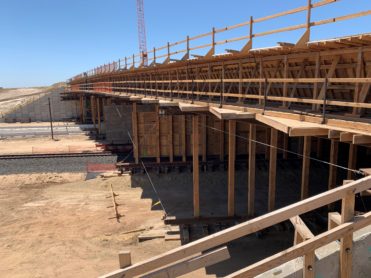
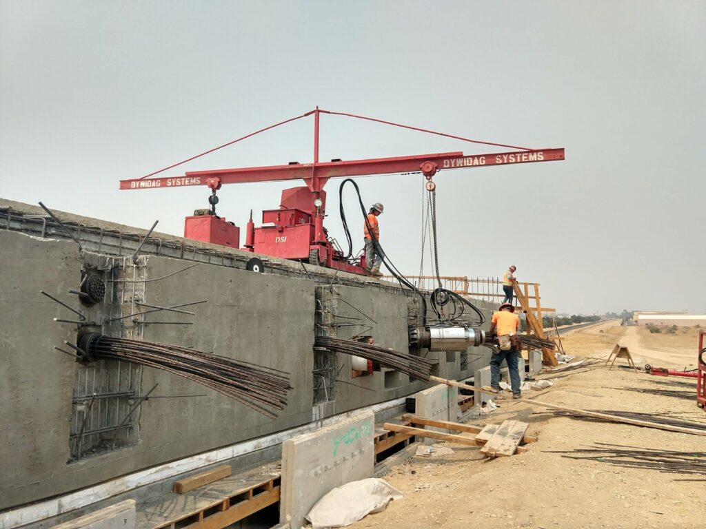
Phase 2 – Veterans Grade Separation – (Under Construction) Phase 2 includes the UPRR and CHSRA grade separation; the southerly jug handle (“J1” as identified subsequently) connecting Veterans Boulevard and realigned Golden State Boulevard; reconstructing Carnegie Avenue to eliminate an at-grade UPRR crossing and; embankment and partial street improvements between the Veterans Boulevard/Bullard Avenue/Riverside Drive intersection and the UPRR/CHSRA grade separation.
Phase 3 – Veterans Interchange Project – (Under Construction) Phase 3 includes: The Veterans Boulevard/State Route 99 interchange; the northerly jug handle (“J2” as identified subsequently); Veterans Boulevard overcrossing of Golden State Boulevard, and; completing Veterans Boulevard between Wathen Avenue and the Veterans Boulevard/Bryan Avenue/Barstow Avenue intersection. This phase also includes the extension of Sierra Avenue to Bullard Avenue.
Phase 4a – Veterans South Extension Project – (Complete) Phase 4a includes: extension of Veterans Boulevard from the Bryan Avenue/Barstow Avenue intersection to Shaw Avenue; and a box culvert at the Herndon Canal.
Phase 4b – Veterans North Extension Project – (Future) Phase 4b includes: the extension of Veterans Boulevard from Wathen Avenue to Herndon Avenue; modifications to Hayes Avenue between Herndon Avenue and Veterans Boulevard, and; improvements to access between Veterans Boulevard and Herndon Avenue.
Phase 5a – Veterans Multipurpose Trail from Hayes to Herndon – (Complete) Phase 5a includes the Class I trail improvements along Veterans Boulevard from Herndon Avenue to Hayes Avenue.
BNSF Blackstone McKinley Grade Separation Project
City of Fresno BNSF Blackstone McKinley Grade Separation Project
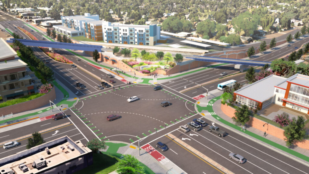
The City of Fresno has awarded a contract to AECOM Technical Services, Inc. (AECOM) for professional engineering services for the design of plans and general construction contract documents for the BNSF Blackstone McKinley Grade Separation Project. The Project is being supported by funding from Measure C and will allow the City of Fresno to create a double grade railroad separation at the busy intersection located just east of Fresno City College. The grade separation Project will eliminate the existing at-grade crossing of the BNSF tracks at North Blackstone and East McKinley separating train traffic from vehicles, pedestrians, and cyclists.
Current conditions at the intersection include:
- An average of 29 trains per day
- Average daily traffic on Blackstone includes 16,742 vehicles, 154 passenger buses, and 17 school buses
- Average daily traffic on McKinley 13,948 vehicles, 46 passenger buses, and 32 school buses
- 210 crossing gates down, blocking events with an average of 2-minutes 48 seconds of delay over a 5-day period
- Four deaths over the last ten years
By moving vehicle traffic to an underpass below the BNSF tracks, several roadway improvement objectives are accomplished including increasing capacity, decreasing traffic flow interruptions, improving safety, decreasing vehicle-pedestrian conflicts, and reducing vehicle-train conflict and delay. The average delay will be reduced at the intersection improving traffic operations, reducing traffic congestion, and lower motor vehicle emissions. The separation will improve emergency service response times, eliminate train horns, and increase railroad operational efficiency.
The Project will support the City’s Southern Blackstone Smart Mobility Plan and will be compatible and build on the “Better Blackstone” initiative. The “Better Blackstone” initiative is intended to diversify and improve land uses along the corridor, make it more pedestrian friendly, and improve its aesthetics. The City is committed to the community driven vision and framework identified in the Southern Blackstone Smart Mobility Plan. Guiding principles for the design work includes:
Identifying safety improvements and access for motorists, pedestrians, bicyclist, and transit riders
Creating a sense of place and identity, embracing Fresno’s rich history and diversity of culture
Incorporating a mix of pedestrian-oriented retail, office, and residential spaces
Providing opportunities for gateway improvements and wayfinding signage
Early utility construction is expected to begin in Summer 2023 and the main grade separation construction in winter 2025 is anticipated to be completed by Spring 2027.
City of Fresno Project Manager, Jesus Avitia, P.E. is available to answer questions at (559) 621-8804 or [email protected].
- BNSF BM Project Flyer
- BNSF BM Project Flyer (Español)
- Blackstone Meeting Recording
- Main Presentation
- Stage Construction Community Input (Survey Monkey)
- Aesthetic Theme Community Input (Survey Monkey)
- Layout Overall
- Community Meeting #1 Questions and Responses
For funding information on this project visit FCTA’s website at https://measurec.com/bnsf-grade-separation/
South Central Fresno AB617 Community Truck Reroute Study and related Health Assessment
Assembly Bill 617 (AB 617), signed by Governor Jerry Brown in July 2017, initiated a state-wide effort to monitor and reduce air pollution, and improve public health, in communities that experience disproportionate burdens from exposure to air pollutants through new community-focused and community-driven actions. The community of South-Central Fresno was selected and identified heavy truck traffic as a source of concern.
Project
The Air District and the City of Fresno have joined forces to undertake the South-Central Fresno AB 617 Community Truck Reroute Study and related Health Assessment, with the City of Fresno Public Works Department taking the project lead. The truck reroute study will identify, analyze, and evaluate potential strategies that freight impacted communities might implement, in cooperation with the City, to abate truck impacts. Such truck impacts include air pollution, noise, polluted runoff, traffic crashes, traffic congestion, active transportation conflicts, residential and school impacts, and excess wear for local pavements and bridges. The study will focus on the analysis of existing and future planned truck routes as defined on the City of Fresno Designated Truck Route Map adopted September 2005. Concurrent with the truck reroute study, a health assessment of the same community boundary will be conducted. The health assessment will (1) seek to assess the extent to which air pollution impacts the risk of common health outcomes across the lifespan, (2) calculate the excess number of cases that are attributed to air pollution in the region, and (3) a community-based health survey will be conducted to explore residents’ concerns, behaviors, health outcomes, and health needs that are relevant to air pollution in the region.
For project info, please visit: https://www.fresno.gov/publicworks/south-central-truck-re-route-study/
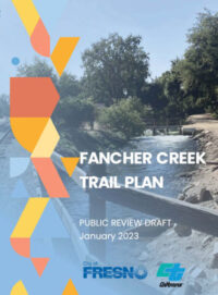
Fancher Creek Trail Plan
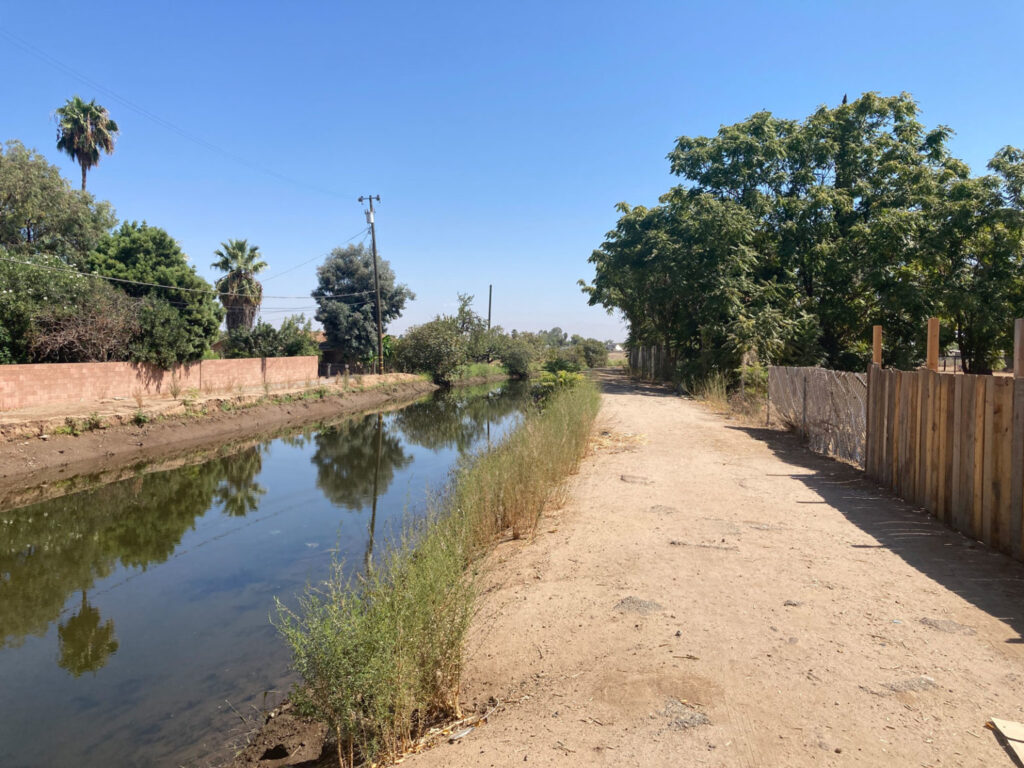
Funded by a Caltrans Sustainable Communities grant, this project will explore the feasibility of and develop conceptual plans for enhancing 5.3 miles of canal bank as a Class I path as a community resource in an underserved and rapidly growing area of the city. The plan includes a robust effort to engage the community that will consist of community meetings, pop-up meetings, school surveys, and a temporary installation/tactical urbanism event. The concept plan will address trail access points, amenities and landscaping, and roadway crossing enhancements. The full plan will include right of way evaluation, cost estimates, and potential funding sources. The completion of the plan will allow the city to apply and compete for additional funding for full design and construction.
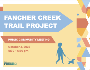
The City of Fresno hosted a community meeting on October 4, 2022 and introduced the Fancher Creek feasibility study project. Here is a link to the meeting recording:
https://tooledesign.egnyte.com/dl/0GOArUGvhk
City of Fresno Project Manager, Isaac Campos, is available to answer questions at (559) 621-8657 or [email protected]
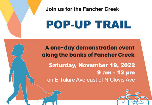
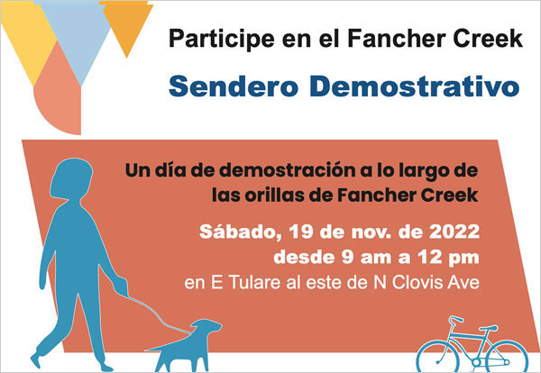
The City of Fresno is eager to hear your thoughts, ideas, and hopes for the Fancher Creek Trail Project. We will host our tactical urbanism event on Saturday, November 19th at the corner of Tulare and Argyle ( E Tulare Ave east of N Clovis Ave). In this meeting, we will introduce the proposed trail alignment and ask for your feedback on concept designs and potential amenities along the trail.
The Fancher Creek Trail Plan studies the feasibility of building an off-street trail (Class I bike path) along the Fancher Creek Canal through southeast Fresno. In an area that is rapidly redeveloping, this project represents a unique opportunity for the City to develop an off-street travel option for people walking and bicycling that will connect to the City’s existing and future active transportation and transit network, as well as schools, parks, shopping, and other important neighborhood destinations.
The City welcomes public feedback on the plan from now until February 10, 2023. Feedbacks can be emailed to the project manager Isaac Campos at [email protected] or 559-621-8657.
Hard copies of the draft plan can be found at Fresno City Hall, Public Works Department: 2600 Fresno St. 4th floor, Room 4016 Fresno, CA 93721
City of Fresno Project Manager, Isaac Campos, is available to answer questions at (559) 621-8657 or [email protected]
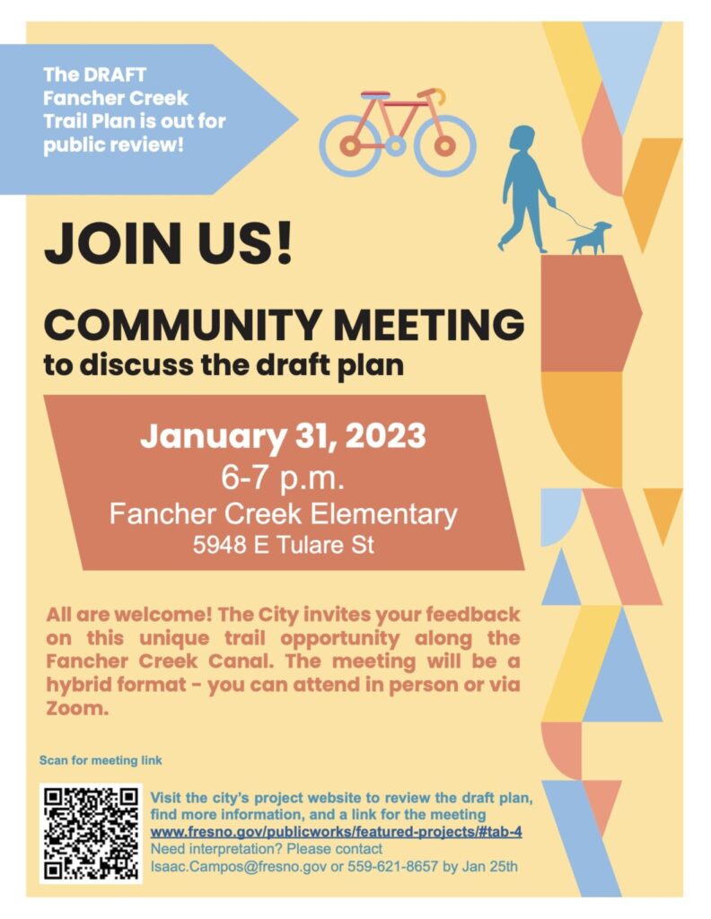
The City of Fresno hosted it’s second community meeting on January 31, 2023 and presented the Fancher Creek Trail Plan. Here is a link to the meeting recording and presentation slides.
City of Fresno Project Manager,
Isaac Campos, is available to answer questions
at (559) 621-8657 or [email protected]
The Systematic Local Roadway Safety Report
The Systemic Local Roadway Safety Report (SSAR) documents the City of Fresno’s work to assess and improve transportation safety conditions citywide. The SSAR serves as the City’s Local Roadway Safety Plan by establishing a vision and goals for transportation safety.
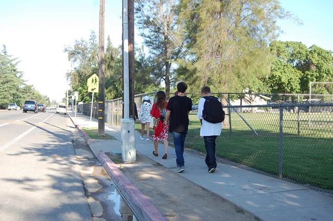
High-Intensity Activated Crosswalk (HAWK) and Beacons
A Pedestrian Hybrid Beacon (PHB) is a relatively new traffic control device, also known as High-intensity Activated crossWalK (HAWK) which makes it safer to cross streets for pedestrians.
The difference between a PHB and a typical traffic signal is that the PHB is dark/inactive until activated by a pedestrian.
LOCATIONS IN FRESNO:
- Bryan Avenue at Acacia Avenue
- Locan Avenue at Cortland Avenue
- Fowler Avenue at the Byrd Avenue alignment
- California Avenue (In Design)
- First & Home (In Design)
- Peach & McKensie Trail
- Grantland & Herndon
- McKinley & Lafayette
- Fresno & Thomas
- Fresno & San Jose
Pedestrian Hybrid Beacon Educational Flyer
Beacon Locations in Development
- Donner & Millbrook
- Alluvial & Sierra Vista
- Browning & Maroa
High Speed Rail
Complete Streets
In October 10, 2019, Fresno City Council adopted the Complete Streets Policy.
A complete street is a transportation facility that is planned, designed, operated and maintained to provide safe mobility for all users while connecting to a larger transportation network
The City of Fresno recognizes the need for complete streets and will accommodate elements that create a complete street wherever it is feasible. A complete street is a transportation facility that is planned, designed, operated, and maintained to provide safe mobility for all users – including bicyclists, pedestrians, transit vehicles, trucks, and motorists – appropriate to the function and context of the facility while connecting to a larger transportation network. Every complete street looks different, according to its context, community preferences, the types of road users, and their needs. All complete streets are designed to balance safety, access, and mobility for everyone using the street and are necessary to create connected networks citywide.
Complete Streets Policy (PDF)
Complete Streets Policy Fiscal Year 2022 Annual Report
Travel by Trail, Fresno! Wayfinding Plan
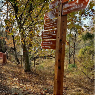
What is wayfinding signage?
Wayfinding signs are used in public places to help people find their way to destinations and preferred routes. You may have seen wayfinding signage near popular visitor destinations, in downtown areas, or even in the airport or at the mall. Wayfinding signage is designed to help people safely and conveniently reach their ultimate destination and is especially important for those traveling on foot, by bicycle, or on transit.
Why does signage and wayfinding matter?
Wayfinding signage provides clear, accessible information to all users traveling on Fresno’s trails. Specifically, wayfinding signage:
Helps visitors and residents become more familiar with options for traveling by transit or bicycle or on foot in Fresno and helps them find the best routes to their destination.
Indicates preferred routes that are intended for bicycling and walking and are thus more comfortable and convenient.
Provides supplemental information like mileage and travel time, which is especially helpful to encourage more short trips to be made by foot or bicycle instead of driving.
Improves safety by alerting drivers to use extra caution around people walking and biking near or along their travel route.
Thanks to the publics feedback, the wayfinding plan for the city’s trail network is now finalized.
Fresno Wayfinding Plan
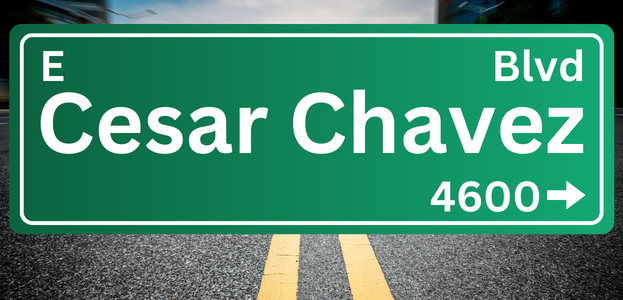
Cesar Chavez Boulevard